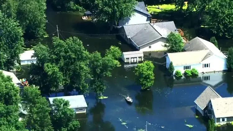
Champlin sits on the Mississippi River, and both of its watersheds drain to it. The city plan names two flood areas, one along Elm Creek and one along the river, and the city offers text and email water alerts to residents who want a head start.
Key takeaways
- The city plan names two flood areas: along Elm Creek, and small areas along the Mississippi River, mostly in its northwest stretch.
- A USGS gauge on the Champlin-Anoka bridge reports to the USGS and National Weather Service sites, and the city offers text and email water alerts.
- River or creek water inside a building is contaminated Category 3 water, so it is handled as flood cleanup and not as a plumbing leak.
- A FEMA Letter of Map Revision effective February 16, 2018 removed about 60 acres from the Elm Creek floodplain after the 2016 dam rebuild.
- Whatever the source, water that reaches flooring and drywall has to come out fast, because mold can start within 24 to 48 hours.
Two water bodies, two flood areas
The Mississippi River is Champlin's main water body for stormwater. Both of the city's watersheds, Elm Creek and West Mississippi, drain to it.
Elm Creek crosses northwest Champlin from the western boundary, runs through Mill Pond and enters the river. Oxbow Creek runs through southeast Champlin to the river, mostly inside Oxbow Nature Park.
Two flood areas appear in the city plan. The first follows Elm Creek, with a floodway and flood fringe reaching south of the channel toward the river.
The second is a set of small areas beside the Mississippi, mostly in its northwest stretch.
- Mississippi River: the receiving water for the whole city.
- Elm Creek: northwest Champlin, through Mill Pond to the river.
- Oxbow Creek: southeast Champlin, mostly inside Oxbow Nature Park.
- Elm Creek Dam: rebuilt in 2016 and called the Mill Pond Dam on the city's history page.
What the 2016 dam rebuild and the 2018 map revision changed
The city rebuilt the Elm Creek Dam in 2016. Then a FEMA Letter of Map Revision, effective February 16, 2018, took about 60 acres out of the Elm Creek floodplain.
The city describes that letter as the proof owners give lenders and insurers that a property may no longer be in the 1 percent annual chance floodplain.
A map revision speaks to floodplain status. It does not say that water can never enter a house through a drain, a sump pit or a window well during a hard rain.
Using the river gauge and the city's water alerts
The USGS put a Mississippi River gauge on the Champlin-Anoka bridge in fall 2017. Its readings go to the USGS and National Weather Service sites, and the city offers text and email water alerts.
An alert only helps if something is done with it, so a short plan is worth having before the river rises.
- Sign up: add a phone number or email address to the city's water alerts.
- Move first: lift stored boxes, electronics and papers off low basement floors.
- Check the pump: confirm the sump pump runs and its discharge is clear.
- Keep records: photograph the lower level before any water comes in, so its condition is on file.
What April 2023 and June 2024 showed
CBS Minnesota reported that the Mississippi spilled its banks in Champlin in April 2023, leaving a riverfront park near the Elm Creek Dam underwater for several days.
By late June 2024 the river was running high and fast. So much debris came down past the Mississippi Crossings docks that the city added staff to keep them clear, while CCX Media described much milder flooding effects in the northwest suburbs.
Those reports describe a park and a set of docks, not flooded homes. They still show how quickly the river can change, and why the gauge and the alerts matter.
River or creek water inside a house
Water that enters from outside has crossed yards, streets and storm drains, so it is treated as Category 3 water. A leak from a clean supply pipe is a different category and a different job.
A river and spring flood cleanup in Champlin follows the contaminated water rules from the first step. Across the Mississippi River, river and spring flood cleanup in Anoka follows the same standard.
What gets removed
Carpet, pad, insulation and drywall that soaked up river water come out, because washing does not make them safe to leave in place. Concrete and other hard surfaces are cleaned and disinfected.
What gets dried
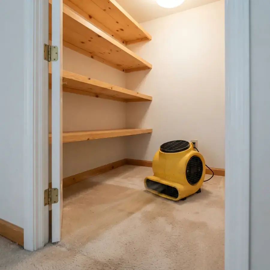
Framing, subfloor and slab are dried with air movers and dehumidifiers. Moisture readings, not the calendar, decide when the work is done.
Heavy rain without a river in sight
Not every wet basement comes from the river. The city notes that runoff from hard surfaces such as roofs, driveways and parking lots moves quickly and in large quantities, and the Hennepin County Soil Survey lists high ground water levels in parts of Champlin.
When standing water gets indoors, water extraction in Champlin comes first, before the water reaches flooring and drywall. Water in a basement after a storm is a Champlin water damage restoration job whether or not a river is involved.
Champlin also goes over the Hennepin County All-Hazard Mitigation Plan with the county every two years, most recently in 2024. The plan covers storms, flooding and extreme heat.
- Gutters and downspouts: keep them clear and pointed away from the foundation.
- Grading: soil beside the house should slope away from the walls.
- Sump pit: test the pump before heavy rain, not during it.
- Low spots: keep valuables off the floor in the lowest room.
The first day after river water gets in
Safety comes before salvage. Flood water can carry sewage, fuel and sharp debris, and it can reach outlets and appliances.
The first day is mostly about three things: keeping people safe, getting the water out and recording what happened.
- Power: if water is near outlets, the panel or a furnace, stay out and have an electrician shut it off.
- Contact: wear waterproof boots and gloves, and keep kids and pets out of the wet area.
- Photos: take pictures of the waterline, damaged belongings and the building before anything moves.
- Extraction: have the standing water pumped out, then check how far it wicked into the walls.
- Sorting: set aside what can be cleaned, such as hard goods, and bag what cannot, such as soaked upholstered items.
Questions
Where do Champlin residents get river water alerts?
The city offers text and email water alerts. The USGS gauge on the Champlin-Anoka bridge reports to the USGS and National Weather Service sites, so the same readings are public.
Does the Letter of Map Revision mean a property cannot flood?
No. The city describes the letter as proof, for lenders and insurers, that a property may no longer be in the 1 percent annual chance floodplain. It is about mapping and does not rule out water entering through a drain, a sump pit or a heavy rain.
Is river water in a basement handled differently from a pipe leak?
Yes. River and creek water is contaminated, so porous materials it soaked are removed and surfaces are disinfected. A clean supply pipe leak can often be dried in place if it is caught early.
Which creeks run through Champlin?
Elm Creek crosses the northwest part of the city and runs through Mill Pond to the river. Oxbow Creek runs through the southeast, mostly inside Oxbow Nature Park, and also reaches the river.
How soon should flood water come out of a house?
As soon as it is safe to enter. Wet drywall, pad and framing can start to grow mold within 24 to 48 hours, so extraction and drying should not wait.
What does the Elm Creek Dam rebuild have to do with flooding?
The city rebuilt the Elm Creek Dam in 2016, and the 2018 FEMA map revision removed about 60 acres from the Elm Creek floodplain. That is a change to the map, and it settles nothing about any one house.